Map Profiles
A map profile:
Is a collection of GIS map services and geocoding services that allow users to connect to the agency’s GIS information providers. The configured GIS services in a map profile provide a mashup or aggregation of map layers.
Provides a centralized and streamlined configuration of GIS services. An administrator can define service connection parameters only once within a map profile, and have the ability to assign the same profile to multiple user groups across multiple product integrations.
Is assigned to user groups. An administrator can set the availability, visibility, and edit permissions of the map layers to the user group. The permission settings are configured on Integrations > User Groups > Map Layer Settings.
The Map Profiles page shows an agency's configured map profiles and their default map service. The following is a sample Map Profiles page:
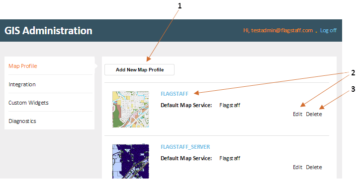
On the Map Profiles page, an administrator can:
1: Add a map profile. Adding a new map profile opens the Map Profile Settings page.
2: Edit a map profile. Editing a map profile opens the Map Profile Settings page.
3: Delete a map profile.
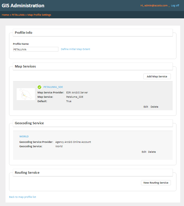
The Map Profile Settings page has the following configuration sub-sections:
- Profile Info - contains the map profile name and link to the Initial Map Extent
- Map Services - a list of map service configurations
-
Geocoding Services - a list of geocoding service configurations
The following is a sample Map Profile Settings page: