Map-based Actions
Performing Actions on Map Items
Accela GIS allows you to perform map-based transactions using the available actions from the menus on the map Contents panel. When you select an area on the map, you can quickly view related transactions and take actions within your current workflow. These menus become enabled after items are selected or searched on the map.- Search for the desired object type (such as an inspection, a record, or a GIS Feature) on the Maps Dashboard. See Civic Platform User Guide > Maps > Searching for GIS Objects for more information.
- On the Search Results tab, select the desired items to perform actions on.
- Click New or More to perform the
actions. The available actions vary based on the type of search performed, or
the type of items plotted on the map.
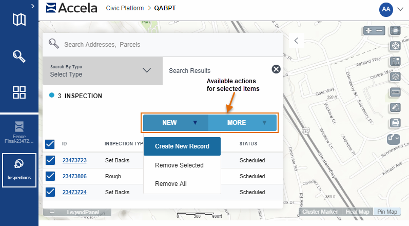
Available Actions
- Create New Record - Opens the application intake form to allow submitting a new record with the selected items.
- Create an Inspection - Opens the inspection scheduling form for the selected items.
- Show Documents - Opens the document list for the selected items.
- Buffer Selection - Selects GIS objects within a specified radius distance from the selected parcels.
- Remove Selection - Remove the currently selected parcel(s) or record(s) from the search results.
- Remove All - Remove all items from the search results.
- Route - Retrieves the necessary route for all the selected items. See the Civic Platform User Guide > Maps > Searching for GIS Objects for more information.
- Export a CSV File - Exports selected parcel and asset information into a CSV file.