Accessing Attachments via a GIS Map
If your agency uses Accela GIS, you can view documents attached to a record or a parcel from a GIS map.
To access attachments from a GIS map
Click the Maps button on the Toolbar.
Accela GIS displays the map viewer.
Search for and select an object on the map.
Accela GIS displays a map overlay or icon on the selected object. The object also displays in the Contents panel.
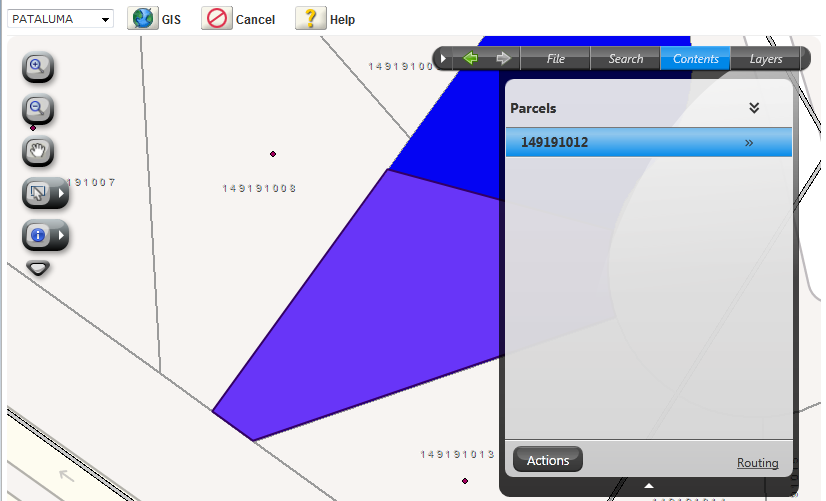
Click the Actions button.
Accela GIS displays the command menu.
Click the Show Documents command.
Accela GIS displays a Document window listing attachments associated with the current parcel, as well as attachments associated with the records related to the current parcel. If the current parcel was generated by splitting or merging historical parcels, the historical parcel numbers are listed in the window. You can click these parcel numbers to view the attachments associated with the historical parcels.
