Configuring External Address, Parcel, and Owner Settings
This topic applies to Accela Silverlight GIS.
Civic Platform can integrate with an external address, parcel, and owner (APO) data source through the external APO web service. One possible external data source is Accela Silverlight GIS. This section describes one of the required configuration tasks that you must complete, if you want to integrate Accela Silverlight GIS as the external APO data source of Civic Platform. For the other configuration tasks, see the Accela Automation External APO Integration Guide in XAPO SDK.zip.
Your agency can have different map integrations. For example, one for Civic Platform, one for Citizen Access, one for Mobile Office online mode, and one for Mobile Office offline mode. However, to use Accela Silverlight GIS as your external APO data source, you must map each Civic Platform reference APO field to an Accela Silverlight GIS map layer field for your agency’s Civic Platform map integration environment.
While you can configure multiple map services for the same integration environment, you can only configure external address, parcel, and owner data for one map service.
To configure external address, parcel, and owner data settings
Navigate to the Additional Settings page.
The Accela Silverlight GIS Administration site displays the Additional Settings page.
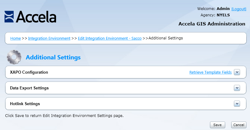
Navigate to the XAPO Configuration section.
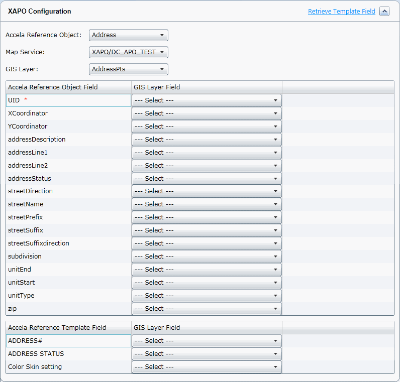
Select a value for each of the following drop-down lists:
Accela Reference Object This drop-down list displays the Civic Platform reference objects, including Address, Parcel, and Owner, that you can map to Accela Silverlight GIS. Note: To use Accela Silverlight GIS as your XAPO data source, you must map all reference objects to Accela Silverlight GIS.
GIS Layer This drop-down list displays all the map layers configured for the map service you select in the Map Service drop-down list. After you select a map layer, the GIS Layer Field drop-down list populates with all the related map layer fields. You must select a map service before you can select a map layer. Map Service This drop-down list displays all the map services configured for you map integration environment. Select the map service for which you want to configure external address, parcel, and owner data from this drop-down list. After you select a map service, the GIS Layer drop-down list populates with all the related map layers. You can only configure external address, parcel, and owner data for one map service.
The Accela Silverlight GIS Administration site populates the Accela Reference Object Field column and the GIS Layer Field drop-down list for each reference object. See Table 1 for a list of Civic Platform reference object fields.
Click the Retrieve Template Fields link.
The Accela Silverlight GIS Administration site populates the template fields retrieved from the APO templates in the Accela Reference Template Field column.
Note: Your agency administrator defines and enables address, parcel, and owner (APO) templates in Civic Platform. Active template attributes can display as Accela reference template fields in the Accela Silverlight GIS Administration site. When you map each APO template attribute to a GIS map layer field, users can retrieve the APO template data from the external APO data source.
Select a value from this drop-down list for each Accela reference object or each template field:
GIS Layer Field This drop-down list displays the layer fields associated with the selected map layer.
Complete one of these steps:
If you want to configure your map integration environment with data export functionality, see Configuring Data Export Settings. If you want to configure your map integration environment with hotlinks, see Configuring Hotlink Settings.
If you do not want to configure your map integration environment with data export functionality or hotlink settings, click the Finish button.
The Accela Silverlight GIS Administration site displays a different page based on whether you are creating or editing a map integration environment.
If you are creating a map integration environment, the Accela Silverlight GIS Administration site displays the Integration Environment Settings page. If you are editing a map integration environment, the Accela Silverlight GIS Administration site displays the Edit Integration Environment page.
Table 1. Reference Object Fields Reference Object Reference Object Fields Address xCoordinator, yCoordinator, addressDescription, addressLine1, addressLine2, addressStatus, addressTypeFlag, auditDate, auditID, auditStatus, city, country, countryCode, county, distance, eventID, fullAddress, houseFractionEnd, houseFractionStart, houseNumberAlphaEnd, houseNumberAlphaStart, houseNumberEnd, houseNumberStart, inspectionDistrict, inspectionDistrictPrefix, levelPrefix, levelNumberStart, levelNumberEnd, lot, neighborhood, neighborhoodPrefix, primaryFlag, secondaryRoad, secondaryRoadNumber, sourceFlag, state, streetDirection, streetName, streetPrefix, streetSuffix, streetSuffixdirection, subdivision, unitEnd, unitStart, unitType, zip Owner UID, address, address1, address2, address3, auditDate, auditID, auditStatus, city, country, email, eventID, fax, faxCountryCode, isPrimary, ivrPinNumber, ivrUserNumber, mailAddress, mailAddress1, mailAddress2, mailAddress3, mailCity, mailCountry, mailState, mailZip, ownerFirstName, ownerFullName, ownerLastName, ownerMiddleName, ownerStatus, ownerTitle, phone, phoneCountryCode, sourceSeqNumber, state, taxID, zip Parcel UID, auditDate, auditID, auditStatus, block, book, censusTract, councilDistrict, eventID, exemptValue, improvedValue, inspectionDistrict, landValue, legalDesc, lot, mapNo, mapRef, page, parcel, parcelArea, parcelNumber, parcelStatus, primaryParcelFlag, planArea, range, section, sourceSeqNumber, subDivision, supervisorDistrict, township, tract