Accela GIS vs Accela Silverlight GIS
Accela GIS
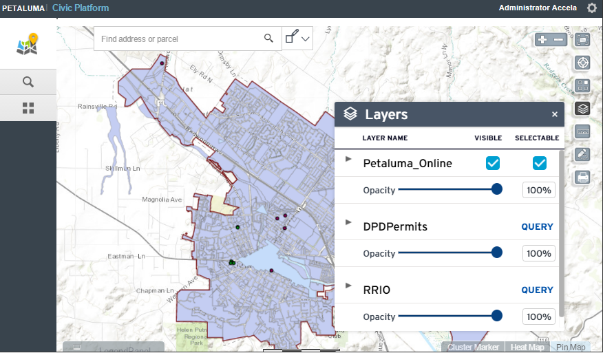
Accela GIS is the JavaScript version of the map viewer embedded in Civic
Platform 8.x and later. Features of the JavaScript map viewer include place locator,
bookmarks, a variety of base maps, redlining, editing and display options when
viewing locations passed from a list, such as cluster marker and heat map.
-
Accela GIS integrates with the 8.x+ (and later versions) of Civic Platform.
Civic Platform 8.x+ allows users to switch to the the legacy (pre-8.x) Civic Platform user interface which uses the Accela Silverlight GIS map viewer. Users can switch to the legacy user interface to use existing features that are not currently available in the JavaScript version.
-
To configure Accela GIS, use the Accela Administration site. For details about GIS Administration, see Configuring Accela GIS.
The GIS Administration site only supports map service and integration configurations for the JavaScript version. GIS Administration is not compatible with existing Accela Silverlight GIS 7.x map service and integration configurations. Existing Accela Silverlight GIS 7.x customers who intend to use Accela GIS 8.x+ will need to define map service configurations using the Accela GIS Administration site. This means that for a limited time, agencies will need to set up both versions of Accela GIS and configure both versions. However, both configurations can point to the same map services.
- Users will switch between the 8.x+ and legacy (pre-8.x) user interface on a daily basis.
- Your agency offers maps in Citizen Access. Civic Platform GIS has integrated with Citizen Access on the module home page and record detail page, but does not yet integrate with other Citizen Access pages.
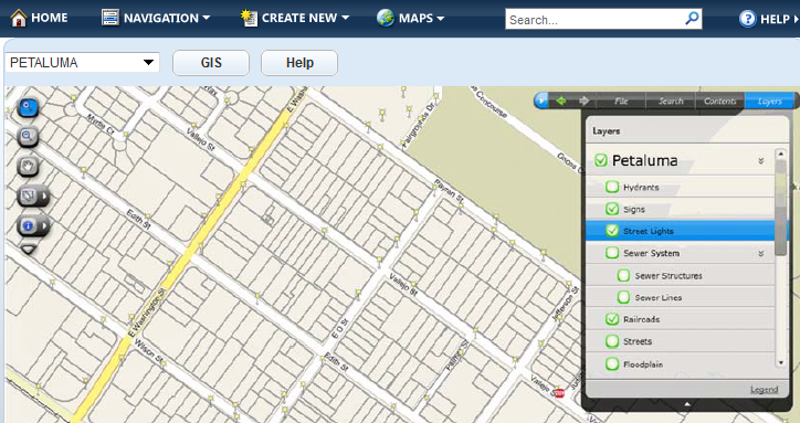
Accela Silverlight GIS
Accela Silverlight GIS is the Microsoft Silverlight version of the map viewer:
-
Accela Silverlight GIS integrates with the legacy versions of Civic Platform (formerly known as "Accela Automation V360"), Mobile Office, and Citizen Access.
- In Civic Platform 8.x+, Accela Silverlight GIS supports the ability to switch to the legacy user interface which uses the Accela GIS map viewer.
- To configure Accela Silverlight GIS, use the Accela Silverlight GIS Administration site. For details about Accela Silverlight GIS Administration, see Configuring Accela Silverlight GIS.