Geocoding Services
A geocoding service controls the visualization of location attributes on a map. For example, a geocoding service is responsible for displaying addresses as street number ranges along street centerlines. If the agency plans to use geocoding in a product integration environment, configure a geocoding service.
Optionally, if you plan to use geocoding in your map integration environment, you can use the Geocoding Service section to retrieve a geocoding service. The geocoding service provider can be ArcGIS Server, ArcGIS Online, or a custom geocoding web service. For information about integrating a custom geocoding web service, see Accela GIS Geocoding Web Service Integration Guide. Contact Accela Customer Support for this supporting document.
The geocoding service you select can be different from the default map service. For example, you might want to use ArcGIS Online for geocoding and an ArcGIS Server map service for mapping, visualization, and layer interaction.
Managing the Geocoding Service
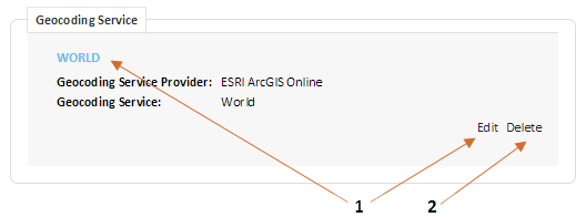
The following diagram shows the Geocoding Service section on a Map Profile page:
On the Geocoding Service section of a Map Profile page, an administrator can:
1: Edit a geocoding service.
2: Delete a geocoding service.
The New Geocoding Service button (not shown above) only appears if the Map Profile does not yet have a geocoding service. Only one geocoding service can be configured in a Map Profile.