Configuring Proximity Alerts in Civic Platform
Proximity alerts facilitate location-based notifications sent to users in their workflow processes. For example, an agency might want to create a proximity alert that checks whether a liquor store business application is within a certain distance of a school. When a proximity alert is defined in Civic Platform, the proximity alert can be added to a Civic Platform workflow process. Civic Platform internally calls either Accela GIS (JavaScript version) or Accela Silverlight GIS to retrieve the GIS data for proximity alerts.
By default, Civic Platform internally uses Accela Silverlight GIS' SOAP-based API to process GIS proximity alerts. Accela GIS (JavaScript version) provides an equivalent GIS REST API that supports proximity alerts. To enable Civic Platform to use the new GIS REST API instead of the legacy SOAP-based API, configure the following standard choice in Civic Platform Administration:
- USE_GIS_REST_API - A new system switch which enables the usage of the Accela
GIS (JavaScript version) REST API.
Add the following standard choice value:
Standard Choice Value Value Description Description YesYesUses the Accela GIS REST API to process GIS proximity alerts. The default value is No, which uses the legacy SOAP-based API.
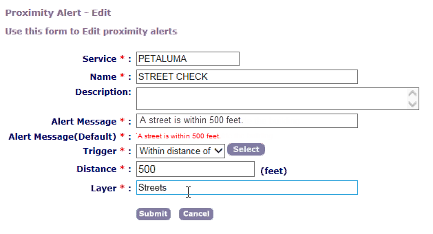
To configure a proximity alert on Civic Platform, go to Admin Tools > GIS > Proximity Alerts, and enter values in the following fields:
| Field | Description |
|---|---|
| Service | The GIS Service ID that has been configured on Civic Platform Administration > Admin Tools > GIS Service. The specified GIS Service must also be configured on the Accela GIS Admin Site. |
| Name | The name of the proximity alert. This name will be included in the list of proximity alerts when configuring workflow proximity alerts. |
| Description (optional) | A description of the proximity alert. |
| Alert Message | The message to be shown to the user when a workflow status change triggers a match in the proximity query. |
| Trigger | The proximity query to be triggered. |
| Distance | The proximity distance (in feet) to use in the query. |
| Layer | The map layer to query. The Layer name must be a valid map layer on the specified GIS Service. |