Defining a Map Integration Environment
This topic applies to Accela Silverlight GIS.
A map integration environment connects your agency’s Civic Platform application and your agency’s GIS system, such as ArcGIS Server or Bing Maps.
To define a map integration environment
If necessary, log in to the Accela Silverlight GIS Administration site.
The Accela Silverlight GIS Administration site displays the administration home page.
Click the Start Map Integration Wizard link.
The Accela Silverlight GIS Administration site displays the Define Integration Environment page.

Complete these fields:
AA GIS Service ID Enter the name of your GIS map service ID, as set in Civic Platform Classic Administration. The field value you enter is case-sensitive. Integration Name Enter the name of your map integration environment, such as Bridgeview - Mobile Office Online Mapping or Bridgeview - Mobile Office Offline Mapping. If you configure an integration environment for Mobile Office, the field value you enter must match the one in the GIS Integration for Online Mapping or GIS Integration for Offline Mapping field on the Mobile Office administration site. This includes uppercase, lowercase, spaces, and any other punctuation.
For specific information on configuring an Mobile Office user group to use Accela Silverlight GIS mapping, see “Managing General Settings” in the Mobile Office Administrator Guide.
Product Use the drop-down list to select the target Civic Platform application. You can choose Accela Automation V360, Mobile Office, or Citizen Access. If you select Mobile Office, an Offline Mapping check box displays. Mark this check box if you want to set up an integration environment for offline mapping. You can only add one map service to the integration environment that you define for offline mapping.
When you configure a map integration for Mobile Office Offline Mapping, you must create a data package. A data package includes the map layer information that Mobile Office users can access and modify when they work offline. When Mobile Office users are online, they can upload the changes to the Accela Silverlight GIS Server.
If you mark the Offline Mapping check box, the Map Integration Wizard directs you to the Offline Map Data Management page after you complete user group configuration. For instructions on how to configure a data package for offline mapping, see Managing Offline Map Data.
Default Mark this check box if you want the map integration environment to display by default.
After selecting the product, the Accela Silverlight GIS Administration site displays the Application Server URL, Accela Automation User Name, and Accela Automation User Password fields.

Complete these fields:
Application Server URL Enter the application server URL. For example, if you select Accela Automation V360 from the Product drop-down list, then you must enter your Civic Platform Application Server URL. In the image above, the Application Server URL is http://biz.ist.accela.com:3080/wireless/GovXMLServlet where biz.ist.accela.com represents your agency’s business application server name. Accela Automation User Name Enter a valid Civic Platform User Name. Accela Silverlight GIS uses the user name that you entered to communicate with the Application Server. Accela Automation Password Enter a valid Civic Platform Password. Accela Silverlight GIS uses the password that you entered to communicate with the Application Server.
Click the Next button.
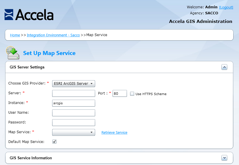
The Accela Silverlight GIS Administration site displays the Map Service Connection page.

Set up a map service connection. For instructions on setting up a map service connection, see Setting up a Map Service Connection.